
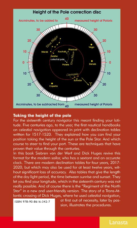
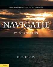
Astonavigation from Columbus to William Barentsz for the modern sailor
Paperback80 pagina’sEngels
Taking the height of the pole
For the sixteenth century navigator this meant finding your latitude. Five centuries ago, to the year, the first nautical handbooks on celestial navigation appeared in print with declination tables written for 1517-1520. They explained how you can find your position taking the height of the sun or the Pole Star. And which course to steer to find your port. These are techniques that have proven their value through the centuries.
In this book Siebren van der Werf and Dick Huges revive this format for the modern sailor, who has a sextant and an accurate clock. There are modern declination tables for four years, 2017-2020, but which may also be used for at least twelve years, without significant loss of accuracy. Also tables that give the length of the day light period, the time between sunrise and sunset. They let you find your longitude, which in the sixteenth century was not really possible. And of course there is the "Regiment of the North Star" in a new and user-friendly version. The story of a Trans-Atlantic crossing of Dick Huges, where he used celestial navigation, at first out of necessity, later by passion, illustrates the procedures.
For the sixteenth century navigator this meant finding your latitude. Five centuries ago, to the year, the first nautical handbooks on celestial navigation appeared in print with declination tables written for 1517-1520. They explained how you can find your position taking the height of the sun or the Pole Star. And which course to steer to find your port. These are techniques that have proven their value through the centuries.
In this book Siebren van der Werf and Dick Huges revive this format for the modern sailor, who has a sextant and an accurate clock. There are modern declination tables for four years, 2017-2020, but which may also be used for at least twelve years, without significant loss of accuracy. Also tables that give the length of the day light period, the time between sunrise and sunset. They let you find your longitude, which in the sixteenth century was not really possible. And of course there is the "Regiment of the North Star" in a new and user-friendly version. The story of a Trans-Atlantic crossing of Dick Huges, where he used celestial navigation, at first out of necessity, later by passion, illustrates the procedures.
In het kort
Bibliografisch
ISBN-139789086163427
Editie1
TaalEngels eng
Pagina’s80
GeïllustreerdJa
Uitgave
Vorm & inhoud
ProductvormPaperback BC
SamenstellingLos product
Classificatie
NUR (hoofd)Maritiem 466
NUR (alle)466 Maritiem
Medewerkers
Auteur A01Siebren van der Werf
Auteur A01Dick Huges
Herkomst
Werk-id (NSTC)500358140
MeldingBevestigd bij publicatie 03
Bijgewerkt6 augustus 2026
Lijkt op dit boek
NSTC 500358140 · CB-relatie 7600021 · Bijgewerkt 6 augustus 2026