
De haven van Rotterdam vanuit de lucht Port of Rotterdam from above
Hardback160 pagina’sMeertalig
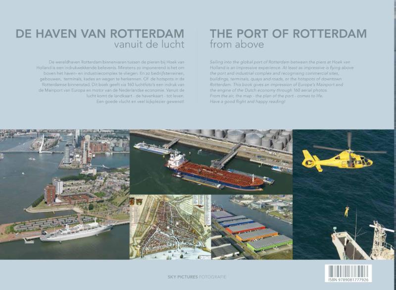
De wereldhaven Rotterdam binnenvaren tussen de pieren bij Hoek van Holland is een indrukwekkende belevenis. Minstens zo imponerend is het om boven het haven- en industriecomplex te vliegen. En zo bedrijfsterreinen, gebouwen, terminals, kades en wegen te herkennen. Of de hotspots in de Rotterdamse binnenstad. Dit boek geeft via 160 luchtfoto's een indruk van de Mainport van Europa en motor van de Nederlandse economie. Vanuit de lucht komt de landkaart - de havenkaart - tot leven.
Een goede vlucht en veel kijkplezier gewenst!
The port of Rotterdam from above
Sailing into the global port of Rotterdam between the piers at Hoek van Holland is an impressive experience. At least as impressive is flying above the port and industrial complex and recognising commercial sites, buildings, terminals, quays and roads, or the hotspots of downtown Rotterdam. This book gives an impression of Europe's Mainport and the engine of the Dutch economy through 160 aerial photos. From the air, the map - the plan of the port - comes to life.
Have a good flight and happy reading!
Een goede vlucht en veel kijkplezier gewenst!
The port of Rotterdam from above
Sailing into the global port of Rotterdam between the piers at Hoek van Holland is an impressive experience. At least as impressive is flying above the port and industrial complex and recognising commercial sites, buildings, terminals, quays and roads, or the hotspots of downtown Rotterdam. This book gives an impression of Europe's Mainport and the engine of the Dutch economy through 160 aerial photos. From the air, the map - the plan of the port - comes to life.
Have a good flight and happy reading!
In het kort
ISBN-13
9789081777926
Uitgever
Verschenen
21 augustus 2015
Imprint
Bibliografisch
ISBN-139789081777926
Editie1
TaalMeertalig mul
Pagina’s160
GeïllustreerdJa
Uitgave
UitgeverSkypictures Luchtfotografie
ImprintSky Pictures
CB-relatie-id7623020
Verschenen21 augustus 2015
StatusInactief 08
BeschikbaarheidContact leverancier 99
Adviesprijs (incl. btw)€ 30,50
Vorm & inhoud
ProductvormHardback BB
SamenstellingLos product
Classificatie
NUR (hoofd)Fotoboeken 653
NUR (alle)653 Fotoboeken
Medewerkers
Herkomst
Werk-id (NSTC)500061805
MeldingBevestigd bij publicatie 03
Bijgewerkt6 augustus 2026
NSTC 500061805 · CB-relatie 7623020 · Bijgewerkt 6 augustus 2026