
Port City Atlas Mapping European Port City Territories: From Understanding to Design
E-book256 pagina’sEngels
Ook verkrijgbaar als
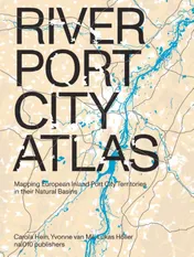
A multitude of port cities dots Europe's coastline, all serving the purpose of facilitating maritime transportation. Over millennia, public and private leaders have built harbours, urban spaces and infrastructures in diverse territories to serve hinterlands, including landlocked capital cities and metropolitan areas. As nodes on the edge of water and land, port city territories embody knowledge on maritime flows and water conditions. At a time of climate change, they can be paradigms and stewards of sustainable development.Taking a comprehensive, mapping based approach, Port City Atlas visualizes 100 port city territories located on four seas and connected through shared waters. It provides a foundation for comparative analysis beyond case study approaches that are often locked into national contexts, select languages or disciplinary approaches. Conceived as a work of reference, the book makes the case for a sea-based approach to the understanding and design of Europe.
In het kort
ISBN-13
9789462087613
Uitgever
Verschenen
1 december 2022
Imprint
Bibliografisch
ISBN-139789462087613
Editie1
TaalEngels eng
Pagina’s256
GeïllustreerdJa
Uitgave
Uitgevernai010 uitgevers/publishers
Imprintnai010 uitgevers/publishers
CB-relatie-id7100743
Verschenen1 december 2022
StatusOnbekend 00
Vorm & inhoud
ProductvormE-book ED
VormdetailE107 PDF
SamenstellingLos product
Beveiliging e-bookDigitaal watermerk 02
Classificatie
NUR (hoofd)Bouwkunst, architectuur 648
NUR (alle)648 Bouwkunst, architectuur
Medewerkers
Herkomst
Werk-id (NSTC)501508579
MeldingBevestigd bij publicatie 03
Bijgewerkt6 augustus 2026
Lijkt op dit boek
NSTC 501508579 · CB-relatie 7100743 · Bijgewerkt 6 augustus 2026