
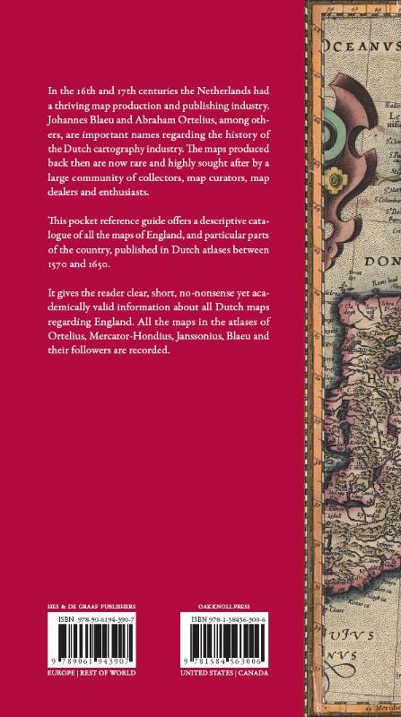
Volume I in a series of 16 pocket reference guides for the historic and antique map collector, map curator and enthousiast. In the 16th and 17th centuries the Netherlands had a thriving map production and publishing industry. Johannes Blaeu and Abraham Ortelius are, among others, important names regarding the history of the Dutch cartographic industry. The maps produced in these three centruries are now relatively rare and highly sougth after by a large communicty of collectors, map curators, dealers of antiquities and enthusiasts. The series will give the reader clear, short, no-nonsense yet academically valid information about all Dutch atlas maps regarding a certain country or area. Each part will mainly address the edition of the atlas(es) in which the maps have been incorporated, the year of publication of the maps, the known states, cartographic references and remarks by the author.This first volume offers a descriptive catalogue of all the maps of England, and particular parts of the country, published in Dutch atlases between 1570 and 1650. All the maps in the atlases of Ortelius, Mercator-Hondius, Janssonius, Blaeu and their followers are recorded.
In het kort
ISBN-13
9789061943907
Uitgever
Verschenen
1 november 2010
Bibliografisch
Uitgave
UitgeverHes & de Graaf Publishers
CB-relatie-id7600533
Verschenen1 november 2010
StatusOnbekend 00
BeschikbaarheidContact leverancier 99
Zonder prijsPrijs volgt
Vorm & inhoud
ProductvormHardback BB
SamenstellingLos product
Classificatie
Medewerkers
Redacteur B01Peter van der Krogt
Redacteur B01Elger Heere
Herkomst
Werk-id (NSTC)500283671
MeldingBevestigd bij publicatie 03
Bijgewerkt6 augustus 2026
Lijkt op dit boek

NSTC 500283671 · CB-relatie 7600533 · Bijgewerkt 6 augustus 2026