
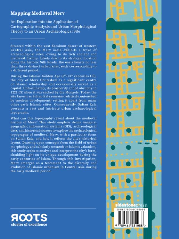
Mapping Medieval Merv An Exploration into the Application of Cartographic Analysis and Urban Morphological Theory to an Urban Archaeological Site
Ook verkrijgbaar als
Foreword of the series editorsPreface of the authorAcknowledgementsChapter 1: IntroductionChapter 2: Geographic and historical contexts2.1 Cultural and historic geography2.2 Site and regional historyChapter 3: Urban morphology3.1 Introduction3.2 Overview of urban morphology3.3 Defining ‘the city’3.4 Variation between cities3.5 Models3.6 Analytical approachesChapter 4: Islamic urbanism and the ‘traditional Islamic city’4.1 Introduction4.2 City and settlement concepts in the medieval Islamic world4.3 Form and arrangement4.4 Urban elements4.5 Circulation spaces4.6 Urban fabric and character4.7 Regional Islamic urbanismChapter 5: Methodology5.1 Data collection: Aerial and remote sensing data5.2 Site data5.3 Data processing, visualisation, and organisationChapter 6: Analysis6.1 Routes6.2 Open spaces6.3 Urban fabric and tissues6.4 Functional and phasal zones6.5 CaveatsChapter 7: Discussion7.1 The topography of Sultan Kala: Its development and evolution7.2 Assessment of the mapping and the resultant dataChapter 8: Conclusions8.1 The utility of urban morphological theory in archaeology8.2 The evolution of medieval Merv8.3 Suggestion for further researchChapter 9: Summary in German / Deutsche ZusammenfassungReferencesAppendixAppendix I: GlossaryAppendix II: TablesAppendix III: MapsSituated within the vast Karakum desert of western Central Asia, the Merv oasis exhibits a trove of archaeological sites, owing to its rich ancient and medieval history. Likely due to its strategic location along the historic Silk Roads, the oasis boasts no less than three distinct urban sites, each corresponding to a different period.During the Islamic Golden Age (8th-13th centuries CE), the city of Merv flourished as a significant centre of Islamic scholarship and occasionally served as a capital. Unfortunately, its prosperity ended abruptly in 1221 CE when it was sacked by the Mongols. Today, the site known as Sultan Kala remains relatively untouched by modern development, setting it apart from many other early Islamic cities. Consequently, Sultan Kala presents a vast and intricate urban archaeological topography.What can this topography reveal about the medieval history of Merv? This study employs drone imagery, geographic information systems (GIS), archaeological data, and historical sources to explore the archaeological topography of medieval Merv, with a particular focus on Sultan Kala, and how it reflects the city’s historical layout. Drawing upon concepts from the field of urban morphology and scholarly research on Islamic urbanism, this study seeks to analyse and interpret the city’s form, shedding light on its unique development during the early centuries of Islam. Through this investigation, Merv emerges as a testament to the diversity and evolution of Islamic urbanism in Central Asia during the early medieval period.
In het kort
ISBN-13
9789464281095
Uitgever
Verschenen
9 oktober 2025
Serie
Bibliografisch
Uitgave
Vorm & inhoud
ProductvormHardback BB
SamenstellingLos product
Classificatie
NUR (hoofd)Archeologie 682
NUR (alle)682 Archeologie
Medewerkers
Auteur A01Loren Cowin
Herkomst
Werk-id (NSTC)501627825
MeldingBevestigd bij publicatie 03
Bijgewerkt6 augustus 2026
Lijkt op dit boek
Mapping landscapes in transformation
The Late Roman Settlement of Umm al-Dabadib
Connectivity Matters!
Mudbrick Settlements of the Oman Peninsula
Urban traditions and historic environments in sindh
Islamic Glass in the Making
From Hinterland to Harbour
Discovering Bukhara
Shaping Cultural Landscapes

Digital Archaeology
NSTC 501627825 · CB-relatie 9180064 · Bijgewerkt 6 augustus 2026